[ad_1]
Lots of questions remain, specifically as to how much snow (or not) Denver will see this weekend.
DENVER — A strong storm could lead to several inches of snow in the mountains and a widespread rain/snow mix in the Denver area this weekend, but the forecast remains highly uncertain due to borderline temperatures and questions about how much precipitation will fall.
After a string of 60-degree days in Denver, a strong storm system will approach from the south and west, leading to a good chance for lots of precipitation across the state.
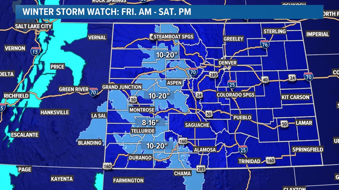
Winter Storm Watches are already in effect for most of the higher elevations, where a widespread 1 to 2 feet of snow looking likely on Friday and Saturday.

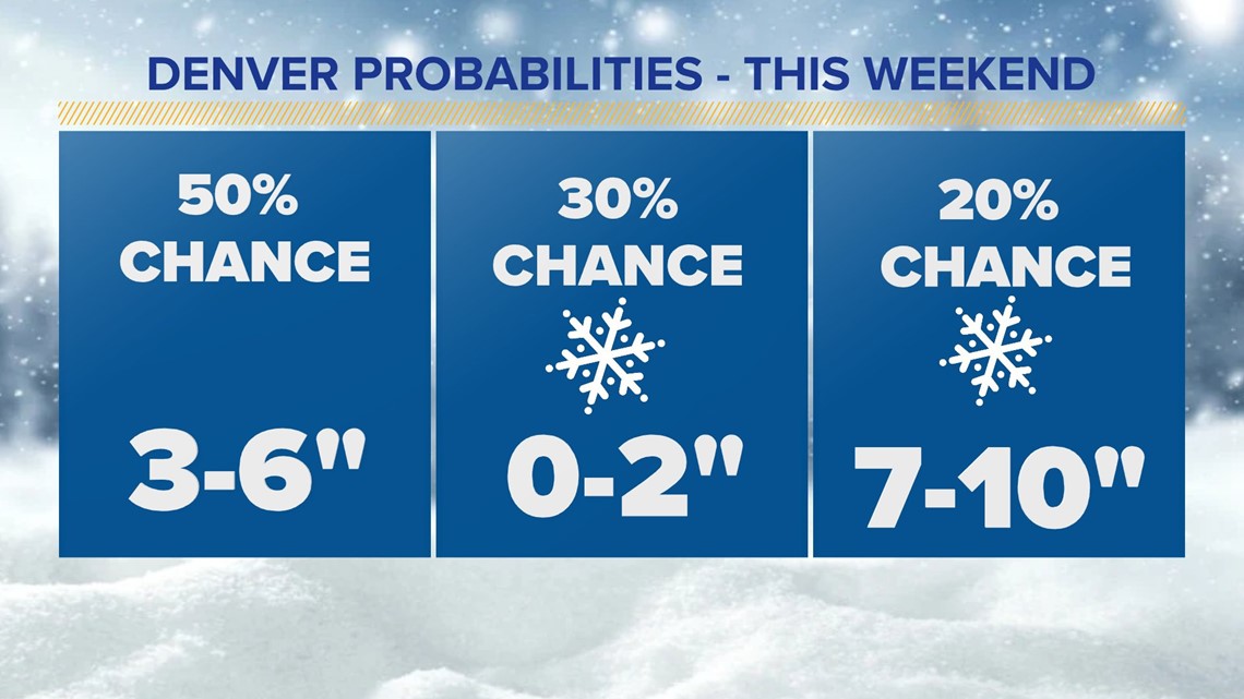
For lower elevations like Denver, the big question is whether that precipitation will fall as rain or snow. Right now, it looks like the majority of the snow will come on Saturday evening and Sunday in the Denver area, with little or no accumulation below 6,000 feet before noon Saturday.
The best chance for accumulating snow in the metro area will likely come Saturday evening and Sunday, when deep moisture from the Gulf of Mexico likely pushes west into the heart of the urban corridor.
At this point, it looks most likely that a medium-sized storm could be in the offing for most of the metro area, but there’s a ton we don’t know still.

There’s an enormous amount of uncertainty with this system. There’s an unusually high amount of moisture, with some models showing close to a full inch of total precipitation from this event. That means that a few degrees could signal the difference between a few inches of slush versus a highly impactful snowstorm.
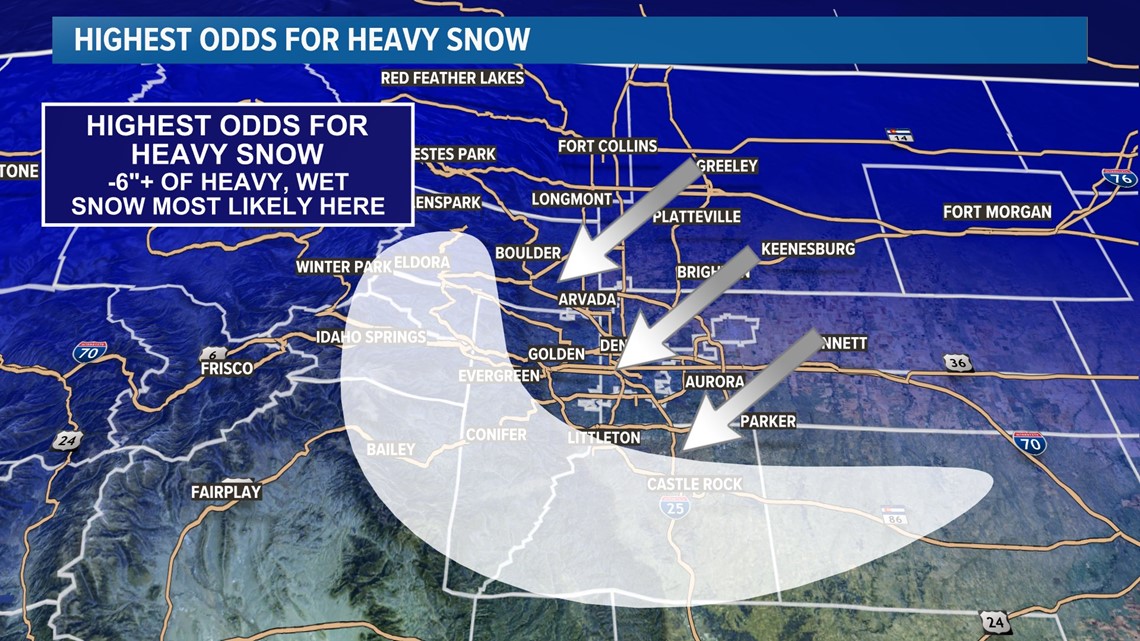
A deep plume of Gulf of Mexico moisture will move in from the east during the day Saturday. Exactly how close that moisture gets to the Interstate 25 urban corridor will likely mean the difference between a little bit of slush versus a highly impactful storm with the possibility for 6 or more inches of accumulation.
Another factor will be the potential for a barrier jet. A barrier jet is a narrow ribbon of wind parallel to the foothills, and it can produce locally heavy snowfall totals. If that sets up on Saturday night or Sunday, a very wide range of snowfall totals could stretch across the metro area. Some spots may only get an inch or two, while others could get double-digit totals.
The highest potential for a heavy snow event appears to lie on the Palmer Divide and our southern foothills, where the best upslope flow (a moist northeasterly wind) and slightly colder temperatures will favor those areas for 6 or more inches of accumulation.

This weekend’s snow will almost certainly fall as a heavy, wet variety. Because temperatures will be right around freezing, there’ll be a high density to the snow. In other words, it’ll be difficult to shovel.
That higher density snow could also lead to downed branches or even trees in areas that get 6 or more inches of accumulation.
This is a low confidence forecast for the metro area at the moment, so be sure to stay with 9NEWS for the latest updates on this possibly significant storm.
SUGGESTED VIDEOS: Colorado Climate
[ad_2]
Source link