[ad_1]
A big weather pattern switch means there will be several snow chances over the next few weeks, starting on Thursday.
COLORADO, USA — This year started on an unusually balmy note in Colorado, with a high of 55 degrees on Monday in Denver, making it the city’s warmest New Year’s Day in nearly 20 years.
But this recent warm and dry stretch is about to come to an end.
It’ll turn much colder later this week, with several chances for accumulating snow in Denver and much of Colorado, starting on Thursday. It’ll stay chilly through this upcoming weekend before another round of snow potentially arrives on Sunday and Monday. Yet another system is possible later next week.
A storm system will spin through California and Arizona on Wednesday and Thursday, kicking off a series of storm systems set to affect Colorado in the next 10 days to two weeks.
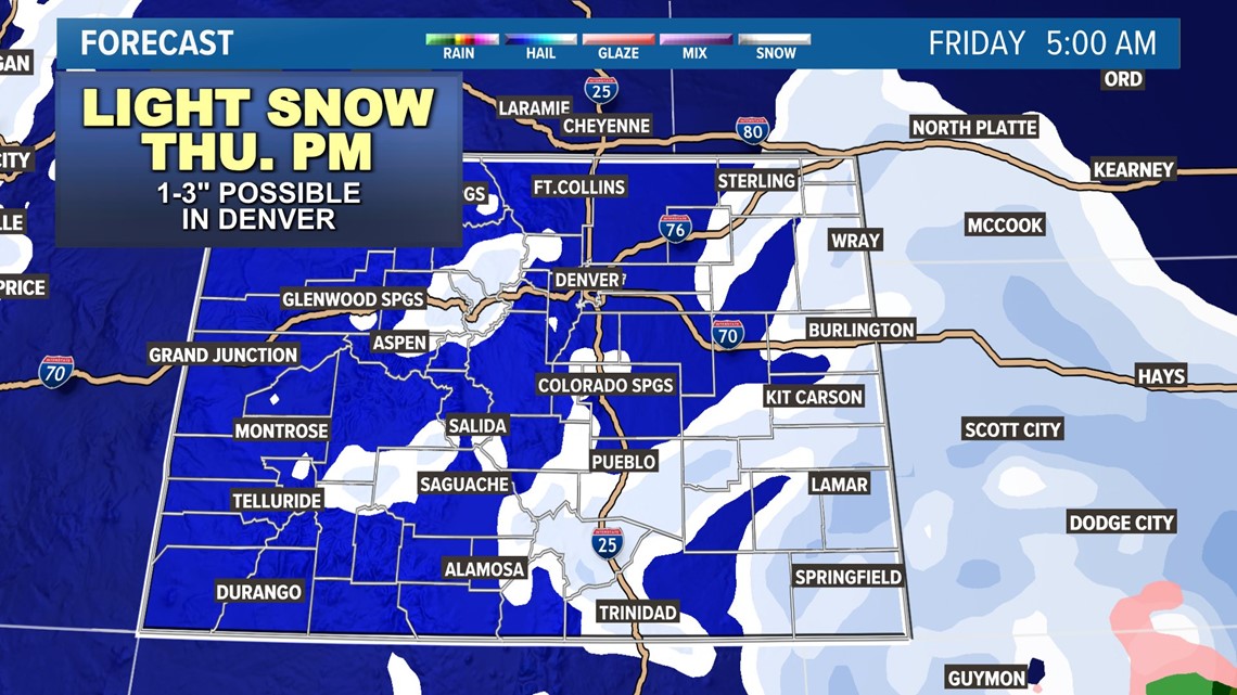
The first storm will mostly pass off to our south, but it looks just far enough north that Denver can expect at least some light snow Thursday night into early Friday morning.
Light snow will likely linger through most of the day Friday, but accumulations look generally quite light, with perhaps 1 to 3 inches across most of the metro area through Friday.

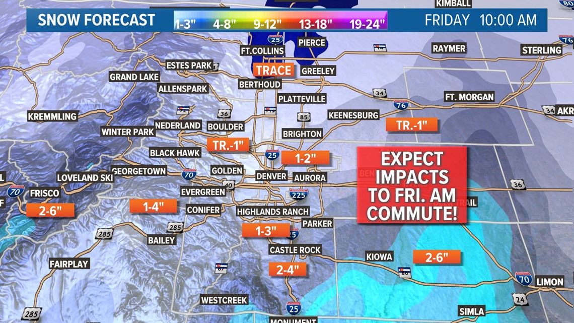
Any snow should end by Saturday morning. Slick roads could slow down Friday morning’s commute in the Denver area.

After a quieter Saturday, another storm system will likely pass through on Sunday night into Monday. This one has the potential to bring a bit more snow than the Thursday/Friday one, but at this point, it doesn’t look like a huge storm.
It’s early for more specifics, other than a likelihood for at least some snow in eastern Colorado on Monday, but we’ll have more on that one as we get closer.
And finally, it looks like we could have yet another storm on Thursday or Friday of next week.
All-in-all, it looks like we’re entering a prolonged cold and snowy stretch across eastern Colorado.
Why we’re confident it’ll turn cold and snowy
There are two main factors adding up to a pattern that points to an unusually chilly and snowy outlook over the next few weeks for much of Colorado.
The first is the jet stream, the narrow ribbon of powerful winds at about 30,000 feet up in the atmosphere that dictates much of our weather. It’ll be strong and focused over the southwestern U.S. over the next few weeks – a classic trait of an El Niño winter. That also increases the odds of seeing regular storm chances in the coming weeks, especially for southern Colorado.
On top of that, the Pacific-North American Pattern (PNA), a measure of air-pressure anomalies between the Pacific Ocean and North America, will turn negative. In the winter months, that’s usually a sign for cold and snowy weather for the western third of the country, including Colorado.
Finally, computer forecast models show those large-scale patterns reflected in an overall cold outlook over the rest of January, with overall below-average temperatures with a parade of lighter snow events looking quite likely.
So if you’ve been hoping for some more classic winter weather, there are a couple of strong indications that we could be entering into a winter-like feel in the coming days and weeks.
SUGGESTED VIDEOS: Colorado Climate
[ad_2]
Source link